
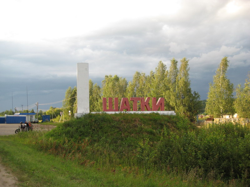
Shatki — a workers' settlement and the administrative center of Shatkovsky District, Nizhny Novgorod Region.
Located 30 km from Arzamas, 150 km south of Nizhny Novgorod, on the Tyosha River, on the Nizhny Novgorod–Penza railway line (a junction station from which a branch line departs to Pervomaysk), and on the Nizhny Novgorod–Saratov highway.
Granted workers' settlement status in 1962. Known since the 16th century under the name Shatkovskiye Vorota (Shatki Gates), it was built as a fortified point on the abatis frontier. Shatki developed into a large trading selo. Modern industry includes a hardware fastener plant, grain-milling and other food-sector enterprises, and organizations serving the district. Near the settlement — along a 20 km stretch of the Tyosha River — lies the renowned Shatki floodplain, with two mineral springs and eight mud lakes. (Source: N. V. Morokhin, "Geographical Local Studies Dictionary," Nizhny Novgorod, Prosveshcheniye, 1993.)
History
According to N. V. Morokhin's "Nizhny Novgorod Toponymic Dictionary" (Nizhny Novgorod, KiTizdat, 1997), the name is associated with the position of Shatki — formerly the Shatkovskiye Vorota — on an abatis line that existed in the 16th–17th centuries: the settlement deviated somewhat from the main defensive line. It is also held that the earliest inhabitants of Shatki were "shatkiy" (unstable, transient) people who came temporarily from other places.
The history of the settlement has been studied at various times by various institutions. The museum of Shatki School preserves historical-monument passports for sites located within the district, compiled in 1949 by Grigory Vasilyevich Varfolomeyev, head of the cultural-education department. Two of the passports describe earthen burial mounds near the villages of Arkhangelskoe and Korino. These mounds were raised in 1552 during Ivan the Terrible's campaign against Kazan to serve as navigational markers for the return journey from Kazan. When piling up the mounds, the soldiers of Ivan the Terrible placed helmets, swords, and other items inside them. The mound near the village of Korino, known locally as the shikh, was investigated around 1912–1913 by a landowner named Bogodurov. The defeat of Kazan by Ivan the Terrible led to the elimination of the Kazan Khanate and the expansion of the Russian state's borders. At that time, a border-guard service was also organized along the Alatyr–Arzamas–Temnikov line. The Arzamas fortress became the military and administrative center of the southern Nizhny Novgorod territory during this period. Historical documents preserve a record of Ivan Khokhlov's appointment as military governor (voivode) in Arzamas in 1578. This date is conventionally regarded as the founding date of Arzamas — making it 425 years old.
Throughout the entire 16th century and into the first half of the 17th, the districts of southern Nizhny Novgorod Region were under threat of military attack from the southern steppes. Bands of nomadic steppe raiders (the chronicles mention hordes of Crimean Tatars) typically swept into the territory in July–August like wildfire, destroying and burning villages and taking thousands of inhabitants captive. In the area around Arzamas and along the Alatyr River, "abatis lines" — defensive lines stretching for tens of kilometers — were constructed. In the conditions of the Nizhny Novgorod Volga Region, forests played the primary role in building these abatis lines. An abatis (zaseka) proper consisted of a continuous strip of forest felled with the treetops pointing toward the enemy. Builders would notch tree trunks so that they remained lying on the stump without being completely separated from it. The resulting wall of chaotically interlocked trunks and branches became entirely impassable for horsemen, which was precisely what was needed in the fight against the nomadic steppe raiders. In the south of Nizhny Novgorod Region, the Vadskaya abatis was built first, crossing the watershed between the Pyana and Serezha rivers. The Arzamas abatis line ran from the bank of the Pyana through Shatki to Ardatov. The "gates" within the abatis lines — passages for the civilian population — were carefully guarded by special detachments of "abatis sentries" or "gate wardens" (vorotniki). 17th-century documents mention the Puzskiye (Pochinkovky District), Sobakinskiye (Krasny Bor), Shatkovskiye, and Ardatovskiye gates in the Nizhny Novgorod abatis lines. In 1619 the tsar granted the village of Bolshoe Boldino to an ancestor of Pushkin. One document subsequently records the following Boldino address: "For the Moscow siege service, his father was granted an estate in the Arzamas district, in the Zalesny stan, beyond the Shatkovskiye Gates…"
In the Arzamas estate records, the Shatkovskiye Gates are mentioned as early as 1583. The origin of the word "Shatki" deserves separate discussion. In chronicle compilations and historical documents, we encounter the adjective Shatkovskiye (gates). The ethnographer Trube holds that the words "Shatki" and "Shatkovskiye" derive from the verb shatatʹsya ("to sway, to wander"). The abatis line from the Pyana River to Ardatov seemed to veer away (otshatnulatʹ) from the main Vadskaya abatis line. One of the passages in this offset section of the abatis came to be called the "Shatkovskiye Gates." When the gates were no longer needed, the settlement that had grown up in that spot came to be called simply Shatki. Initially, Cossacks from the village of Vyezdnoye, near Arzamas, guarded the Shatkovskiye Gates. Later, the passage through the gates was watched by young men recruited from the local population at a rate of one per twenty households. They married, started families, and settled near the gates. The settlement enjoyed a favorable geographic position: flat terrain, a river, water-meadows, and forest. This allowed the inhabitants of Shatki to engage in hunting, beekeeping, farming, and cattle-raising. Under the administrative reform carried out by Catherine II, Shatki became part of the Arzamas district of Nizhny Novgorod Governorate. In 1873 the zemstvo opened a three-grade primary school in Shatki. The first teacher was Pyotr Sergeyevich Seledkin, who taught local children for more than 40 years. In 1898 a railway line from Nizhny Novgorod to Penza was built near Shatki. A new street quickly developed along the railway and was named Stantsionnaya (Station Street). Shatki continued to grow. In the early 20th century it became a volost (township) center, and in 1929 a district center.
Monuments
Archaeological monuments
- Shatki-3 site (5th millennium BC),
- Shatki-7 site (Bronze Age). State protection registration documents No. 559, No. 204.
Historical monument
- The grave of Tanya Savicheva, a Leningrad schoolgirl who died in 1944 following the Siege of Leningrad. State protection registration document No. 559. In memory of the heroes of the Great Patriotic War and the children who perished during it, a large memorial has been erected in Shatki. On 19 July 1942, a train carrying children from the besieged city of Leningrad arrived at Shatki station. Among the children was Tanya Savicheva, whose name has been inscribed in world history through her legendary diary. For more details, see Mikhail Tyulnikov's piece "Dedicated to Tanya Savicheva."
Architectural and urban-planning monument
- Trinity Church (1788). Status-granting document: order of 24 April 2000, No. 5-OD. GPS coordinates: N55.188119 E44.126417